

Janes
ArcGIS Pro Mapping & Data Visualisation
Project: Diverse mapping initiatives utilising ArcGIS Pro and Adobe Illustrator
Client: Janes internal colleagues
Location: Croydon, United Kingdom
Description:
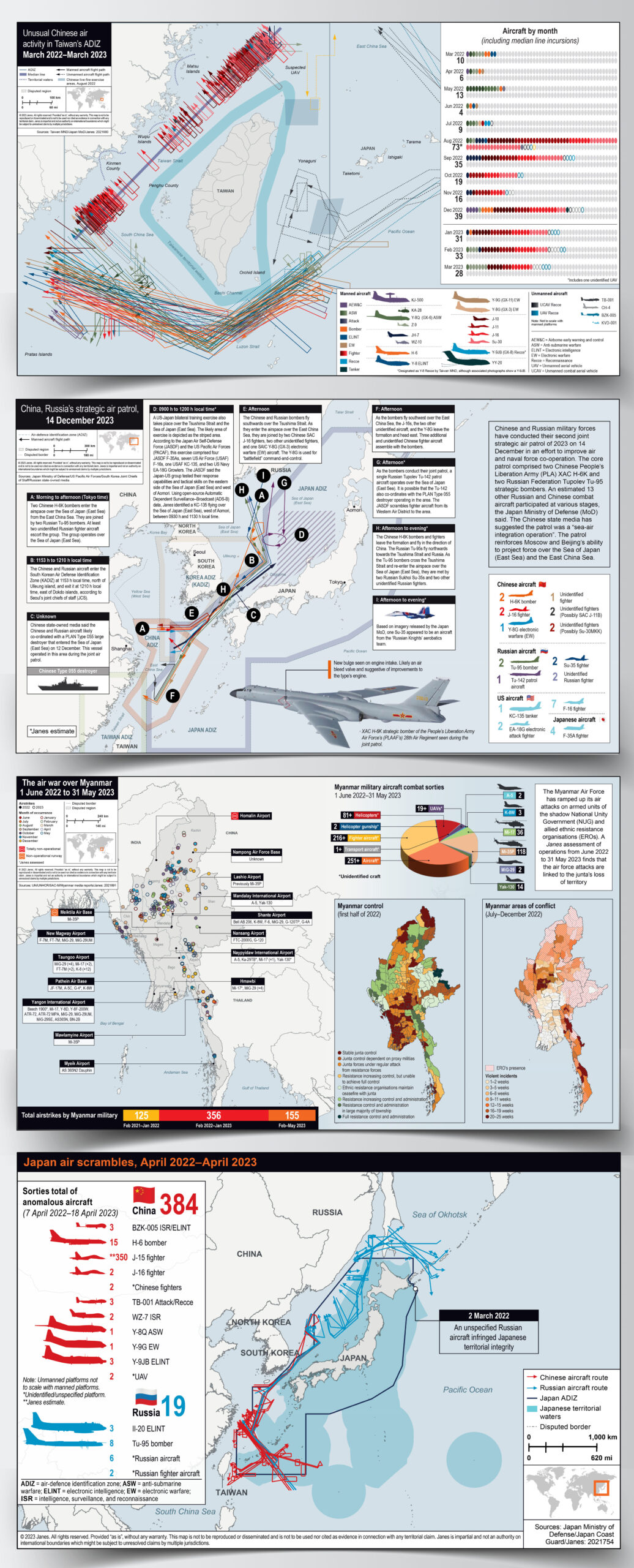
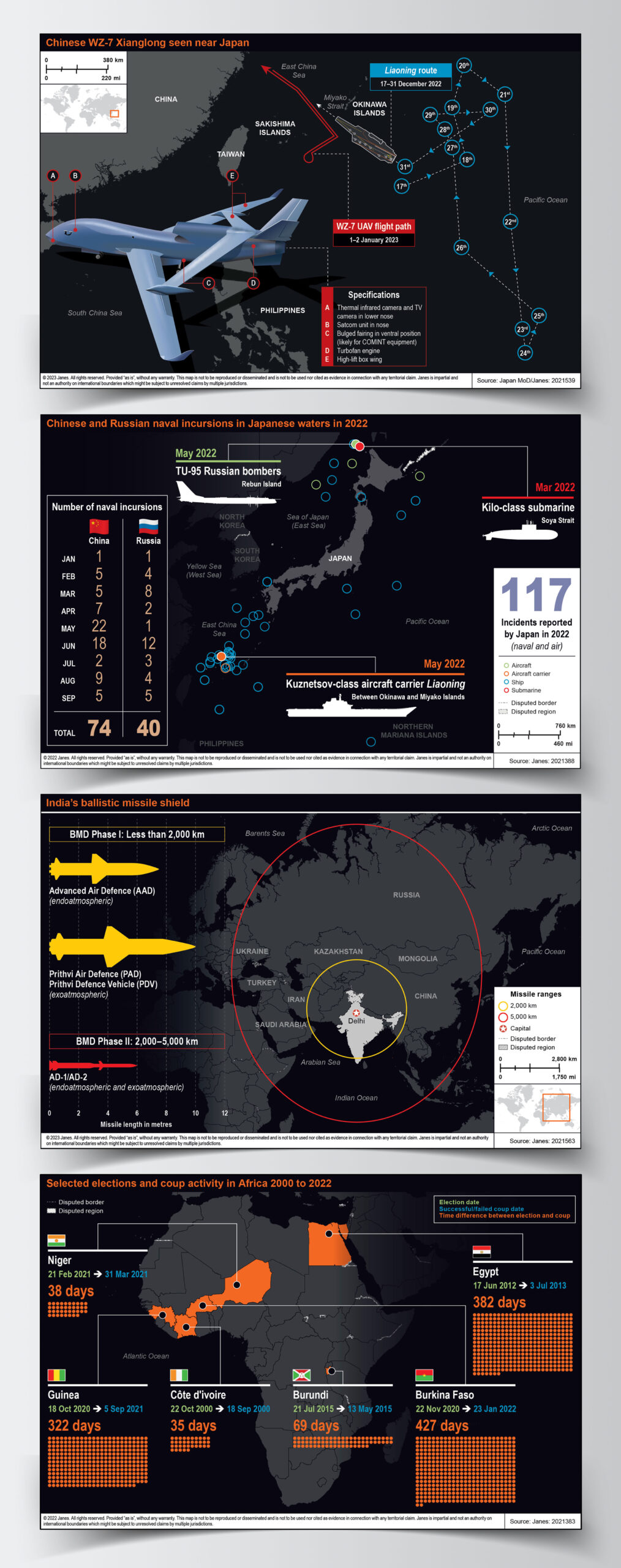
At Janes, mapping plays a crucial role in delivering real-time data insights. Through ArcGIS Pro, complex geospatial data is transformed into detailed, reactive visualisations that support global intelligence and analysis. By collaborating closely with reporters and analysts, each map is tailored to highlight critical developments with clarity and precision.
Every project integrates both technical accuracy and artistic craftsmanship—while ArcGIS Pro manages data processing, bespoke illustrations of military assets, aerial craft, and strategic elements are meticulously created in Adobe Illustrator. This seamless blend of advanced mapping technology and hand-drawn design ensures that Janes’ visual narratives are both informative and impactful, providing essential intelligence in a dynamic global landscape.